 rivers | guidebooks | forums | tips | other
.jpg)
(photo by Boris Trgovcich)
Class: III; Ave. Gradient: 1 m/km; Portages: one long one, and maybe wood; Length: 13 km; Time: 3+ hours
Season: better July to February; rafts? no; Highlights: playing hide-n-seek with the river in the caves and with the monkeys in the jungle; Crux move: finding the right portage trails and bringing your headlamp
Water Quality: decent; Water Temperature: medium
PI: Chahal-Sibajá bridge (170 m); TO: Santa Rita
Description: (click here for general notes about my descriptions)
The Upper Río Chiyú is an adventure trip through some exceptional jungle and around some exceptional caves. This part of the country has many caves to explore, many harboring underground streams. The Río Chiyú is one of the largest rivers to pass through a cave. Unlike the Candelaria Caves, you can’t paddle through, but the scenery and convenient location of the Chiyú-Setzol caves makes this run an attractive option for cave touring. Note that the cave access is on private land and an entrance fee is expected; see the logistics section.
A full description is in the Mayan Whitewater Guatemala guidebook.
Descent History: George Pratsinak, Peter Zurflieh, and I explored this one in February 2014, with a low 250 cfs. Duckie Dynasty II made it through in 2015 with about 1,600 cfs.
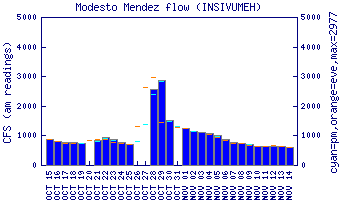
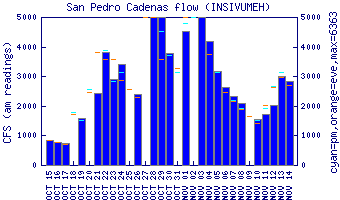
Flow Notes: There are gauges downstream on the Río Gracias a Dios, shown below (flows uncorrelated). If I’m very curious about the flow I call Felipe at Oasis Chiyú. The character of this run does not change much with normal variations.
 |
 |
Nearby Tourist Attractions: Las Conchas Falls downstream.