 rivers | guidebooks | forums | tips | other
Class: IV-; Ave. Gradient: 15 m/km; Portages: none; Length: up to 24 km; Time: up to 4:00
Season: June to October; rafts? no; Highlights: low-stress creeking; Crux move: picking out a good taco place afterwards
Water Quality: decent; Water Temperature: not noted
PI: Manuel Lazos bridge (elev: 375 m); TO: 1 of 2 bridges east of Tapachula
Description: (click here for general notes about my descriptions)
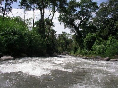
The Río Cahoacán is one of the longest intermediate creek runs around. It has nice scenery and an easy shuttle. The run is fast and easy relative to the gradient and the rapids never get cliffed-in.
A full description is in the Mayan Whitewater: Chiapas & Belize guidebook.
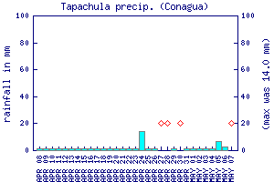
Flow Notes: There is no very close online gauge, though other coastal gauges can give you an idea of trends, as can the Tapachula rain gauge, shown below. The river is down more than it's up. You will pre-scout at the highway bridge on the way from Tapachula (where the river includes flow from the Río Cahoa. My impressions are from a run with 250 cfs at the PI.
 |
Accommodations: Tapachula makes a convenient base for this run.
Nearby Tourist Attractions: Proto-Mayan ruins at Izapa; Tacaná volcano; Puerto Madero beach.