 rivers | guidebooks | forums | tips | other
Class: III- to III+ ; Flow: 500-3,500 cfs; Ave. Gradient: 3 m/km; Portages: none; Length: up to 41 km; Time: 1.5-7 hours
Season: June to November ; rafts? yes; Highlights: big play waves; Crux move: coordinating the take-out
PI: Santa Rosa bridge (428 m) or Río Guajoyo; TO: Los Jobos (305 m) or above
Description: (click here for general notes about my descriptions)
The Río Lempa is by far the longest and largest of El Salvador's rivers and in fact drains about half of El Salvador's area (and a small chunk of Honduras and Guatemala). The river is also an important source of electrical power for the country, with three large dams along its length. The Middle section is above the first dam and therefore free flowing, except for the significant contribution of the dam-release Río Guajoyo that enters along the way. The Middle section flows through pretty mountain scenery and maintains a fairly wide riverbed from top to bottom. There are several ways to break up the run if so desired.
A full description is in the Mayan Whitewater El Salvador, Honduras, & Nicaragua guidebook.
Descent History: The first descent is unknown. Currently the Balneario Apuzunga guys do rafting here.
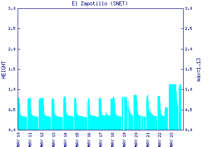
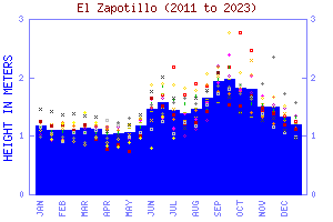
Flow Notes: This river has fairly reliable water during the rainy season. There is an online gauge at El Zapatillo (see history graph) which includes the Río Guajoyo flow. In 2019, 1.85 on the gauge gave about 5,000 cfs. In 2018, 1.5 on the gauge gave 3,000 cfs.
 |
 |