 rivers | guidebooks | forums | tips | other
Class: III, II ; Flow: 50-400 cfs; Average Gradient: 7 m/km, 3 m/km; Portages: perhaps; Length: 10 + 9 km; Time: 2 + 2 hours
Season: June to October ; rafts? no; Highlights: fun bedrock chutes, easy shuttle; Crux move: avoiding bedrock
Put-In: El Portillo (130 m); Take-Out: Interamericana Highway (63 m) or La Unión highway (40 m)
Description: (click here for general notes about my descriptions)
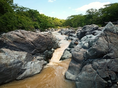
The Río Las Piñas is a small creek usually too low run to run, but is worth looking at if you are driving to or from Honduras. The run is down to the Inter-American Highway and chock full of fairly easy pretty bedrock rapids and tight chutes, with about half of them being nicely channeled and enjoyable even at low water (the rest? well...). Your boat will take plenty of abuse though, and you may need to do a short portage once or twice depending on flow. Wear elbow pads. There is easy access at many spots to limit the kilometers and boat damage. There are fewer rapids in the second half but they have a little more water. The birding is pretty good too.
A full description is in the Mayan Whitewater El Salvador, Honduras, & Nicaragua guidebook.
Descent History: I ran this in September 2019 with 50 cfs at the start and 150 cfs at the end.