 rivers | guidebooks | forums | tips | other
Class: V ; Flow: 250-2,000 cfs; Average Gradient: 6 m/km; Portages: one or more; Length: 10 km; Time: 4 hours
Season: June to October; rafts? no; Highlights: volcanic rock formations; Crux move: careful scouting
Put-In: road bridge (235 m); Take-Out: Susuma hammock bridge (175 m)
Description: (click here for general notes about my descriptions)
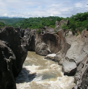
The Middle Río Negro is a fine obstacle course among interesting rock formations involving extended scouting. The craziest of the geological art is in the second half, where the flow is doubled by the Río San Juan. This is one run where the water level will change the paddling lines significantly, so take my ratings and timings with a grain of salt.
A full description is in the Mayan Whitewater El Salvador, Honduras, & Nicaragua guidebook.
Descent History: I ran this with George Pratsinak in June 2005, with 350 cfs at the start and 1,400 cfs at the end.