 rivers | guidebooks | forums | tips | other
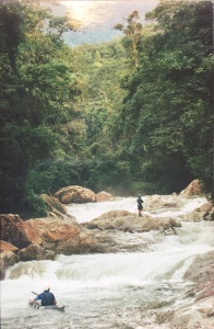
(photo from Kent Forte)
Class: III, V ; Flow: 100-300 cfs; Average Gradient: ~23 m/km (map on page 159); Portages: ; Length: 3 km; Time: 2 hours
Season: ; rafts? no; Highlights: ; Crux move:
Put-In: Pico Bonito National Park (~125 m); Take-Out: highway (35 m)
Description: (click here for general notes about my descriptions)
Pico Bonito National Park, just southwest of La Ceiba, is Honduras' second largest national park and an important nature reserve. Its rugged terrain contains many steep creeks that only run deep after a storm. These two streams run out of the Park's scenic heart.
A full description is in the Mayan Whitewater El Salvador, Honduras, & Nicaragua guidebook.
Descent History: