 rivers | guidebooks | forums | tips | other
Class: III; Ave. Gradient: 15 m/km; Portages: one class IV; Length: 5.5 km; Time: 45 minutes
Season: June to October; rafts? no; Highlights: run; Crux move: catching the water
Water Quality: decent; Water Temperature: medium
PI: San Pedro Cutzán (325 m); TO: Montecristo bridge (240 m)
Description: (click here for general notes about my descriptions)
The Río Tarro is a short run on a tributary of the Río Cutzán. It is not particularly noteworthy except that it gives an opportunity for intermediate boaters to work on their creeking skills.
A full description is in the Mayan Whitewater Guatemala guidebook.
Descent History: I got on this solo in September 2009.
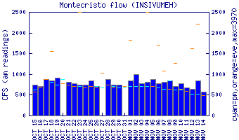
Flow Notes: Heavy rains are needed. If the Río Cutzán is up the Río Tarro may be also. There is a gauge downstream on the Río Cutzán at the Montecristo bridge.
 |
Nearby Tourist Attractions: not much in this area.