 rivers | guidebooks | forums | tips | other
Class: IV-; Ave. Gradient: 14 m/km; Portages: none; Length: 12 km; Time: 2 hours
Season: June to October; rafts? yes; Highlights: getting "mojado" at the border; Crux move: avoiding the smugglers
Water Quality: poor; Water Temperature: warm
PI: Puente Talisman (elev: 335m); TO: Rancho Marilandia
Description: (click here for general notes about my descriptions)
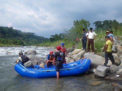
The Río Suchiate forms the border with Mexico near the Pacifi c coast. The Main section starts at the border crossing nearest Tapachula, Mexico, known as Talisman or El Carmen (the town on the Guatemalan side). The gradient is consistent in this section and forms long rapids with short pools in between. The river stays open and wide from here on down, and the rapids are fun, though have little to distinguish themselves from each other.
A full description is in the Mayan Whitewater Guatemala guidebook..
Descent History: Probably rafters from Tapachula were the first to run the Suchiate, but I don't have the beta. I have run it two times, the last time in 2010.
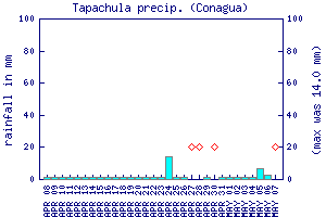
Flow Notes: The Río Suchiate always has some water in the rainy season but I like to see at least 800 cfs (the more the better). Conagua (Mexico’s National Water Commission) has a gauge at Talisman, though it has been broken for a long time. The gauge on the parallel Río Cabúz is helpful to seeing the rain in the area. The Tapachula rain gauge, shown below, may give some clue to recent rainfall patterns. The more water, the better, on this run. In dry spells rafters might have a hard time getting down.
 |
 |
Nearby Tourist Attractions: Not much close by.