 rivers | guidebooks | forums | tips | other
 corr.jpg)
Class: IV; Ave. Gradient: 16 m/km; Portages: one big one; Length: 9 km; Time: 1.5 hrs + hike
Season: June to November; rafts? no; Highlights: gorgeous canyons; Crux move: hiking in, and the La Chorrera portage
Water Quality: decent; Water Temperature: medium
PI: Finca Managua (480 m); TO: El Carmen/Talisman (335 m)
Description: (click here for general notes about my descriptions)
The Río Suchiate forms the border with Mexico near the Pacific coast. Its drainage area reaches deep into the coastal range, and it cuts an especially deep trench between the Tacaná volcano and Tajumulco volcano, the two highest peaks of Central America. In the course of my research, I discovered that this trench is littered with impassable class VI cataracts. The adventurous trip to the Upper run takes you on a hike to the last of these cataracts, and then lets you float through two final beautiful passages. Some good whitewater also awaits.
A full description is in the Mayan Whitewater Guatemala guidebook..
Descent History: My first descent was in September 2006. I hiked in from Finca Managua once in July 2014.
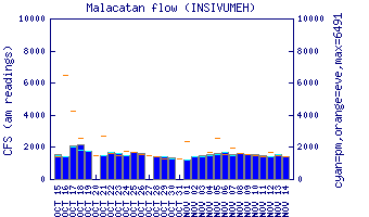
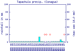
Flow Notes: The Río Suchiate has enough water in the rainy season but during dry spells the rapids get bony. Conagua (Mexico’s National Water Commission) has a gauge at Talisman, though it has been broken for a long time. The gauge on the parallel Río Cabúz is helpful to seeing the rain in the area. Historical records from that gauge show average flows in the rainy season to be 1,000 cfs, but it seems reduced nowadays. The Tapachula rain gauge, shown below, may give some clue to recent rainfall patterns.
 |
 |
Nearby Tourist Attractions: Not much close by.