 rivers | guidebooks | forums | tips | other
Class: II, III; Ave. Gradient: 6 m/km; Portages: none; Length: up to 23 km; Time: 3-4 hours
Season: June to October; rafts? no; Highlights: hot springs; Crux move: catching the water
Water Quality: poor; Water Temperature: not noted
PI: Malá bridge (1706 m); TO: Cancabal (1642 m) or Puente Pa’aj (1575 m)
Description: (click here for general notes about my descriptions)
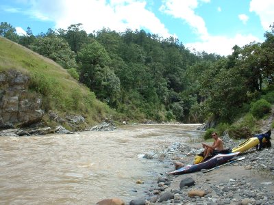
The Upper Río Serchil and the Río Malá off er some easy whitewater, plus a nice pit-stop at a rustic hot spring. The first 13 km down to Cancabal is one of the nicest class II runs in Guatemala, with forest scenery deep in the hills. The last rapid is a little tougher (III-) so watch out for that.
A full description is in the Mayan Whitewater Guatemala guidebook.
Descent History: Mark Shimanski and I ran this September 2005, with 250 cfs at the PI.
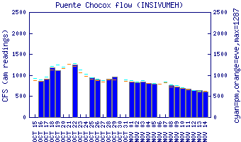
Flow Notes: The Upper Río Serchil is hard to catch. The rain gauges at Huehuetenango and Quetzaltenango need to be measuring rain every day. The Río Negro (phone) reading needs to be at least 1.40. The gauge on the Lower section, shown below, will give a hint to relative levels in the drainage.
 |
Nearby Tourist Attractions: Agua Caliente hot springs.