 rivers | guidebooks | forums | tips | other
.jpg)
Class: III-; Ave. Gradient: 7 m/km; Portages: none; Length: 9 km; Time: 1:30 hours
Season: August to October; rafts? no; Highlights: catching the water; Crux move: catching the water
Water Quality: poor; Water Temperature: not medium-cool
PI: Las Lagunas bridge (1830 m); TO: Palajachuj (1765 m)
Description: (click here for general notes about my descriptions)
The Río Selegua is a long river with lots of whitewater and impressive scenery. The Top section is where it all begins, but is run even less often than the other sections mainly due to a usual lack of water. In addition, the water has even a higher concentration of pollutants, being just downstream of Huehuetenango and Chiantla.
A full description is in the Mayan Whitewater Guatemala guidebook.
Descent History: I got on this in August 2010, with 150/700 cfs at the PI/TO.
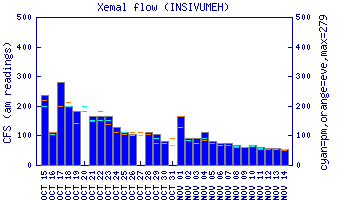
Flow Notes: There is an online gauge on the Upper section, though flows have not been correlated. There is also an online gauge way downstream in Mexico on the Río San Gregorio (Puente Concordia gauge). You will need heavy recent rains to have a go here. In 2010, 15,500 cfs on the gauge gave 150 cfs at the PI.
 |
 |
Nearby Tourist Attractions: Zaculeu Mayan ruins