 rivers | guidebooks | forums | tips | other
Class: II; Ave. Gradient: 1.3 m/km; Portages: none; Length: 6 km; Time: 1-1.5 hours
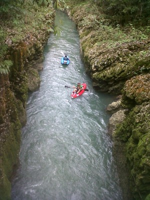
Season: June to January; rafts? no; Highlights: narrow mini-canyon; Crux move: short hike out
Water Quality: decent; Water Temperature: medium
PI: Chaquiquiché bridge (200 m); TO: El Porvenir Dos (192 m)
Description: (click here for general notes about my descriptions)
The Río San Simón is a pretty float and right on your way if you are going through Chisec. There are not many rapids, but the cave rock-jungle scenery along the banks is atmospheric.
A full description is in the Mayan Whitewater Guatemala guidebook.
Descent History: Roberto Rodas, Max Baldetti, Sydney Shaw, and I checked this out in December 2012. Many tourists preceded us on the lower part.
Flow Notes: The Río San Simón maintains a barely-floatable flow from July to January. The more rain recently, the better.
Nearby Tourist Attractions: Bombil Pek cave.