 rivers | guidebooks | forums | tips | other
.jpg)
Class: III; Ave. Gradient: 9 m/km; Portages: maybe due to wood; Length: 25 km; Time: 4.5 hours
Season: September to January; rafts? no; Highlights: pretty gorges and nature; Crux move: catching the water
Water Quality: good; Water Temperature: warm
PI: Las Pacayas (280 m); TO: El Milagro
Description: (click here for general notes about my descriptions)
The Río San Marcos is a creek descending from the small Cerro San Gil nature reserve. If you are able to catch the water, you will be treated to pretty jungly canyons and decent birding, and a lengthy sequence of intermediate rapids.
A full description is in the Mayan Whitewater Guatemala guidebook.
Descent History: George Pratsinak and I did this one in November 2011.
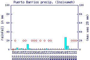
Flow Notes: This small river does not come up too often, and there is no online gauge. The nearby Puerto Barrios rain gauge is perhaps your only online hint.
 |
Nearby Tourist Attractions: Río Dulce canyon boat trip and Garifuna culture in Livingston.