 rivers | guidebooks | forums | tips | other
Class: II/II+; Ave. Gradient: 7 m/km; Portages: none; Length: 16 / 14 km; Time: 2 hours
Season: June to October; rafts? if high; Highlights: good practice; Crux move: ignoring the trash
Water Quality: poor; Water Temperature: not noted
PI: San José La Arada (418 m) or Vado Hondo (420 m); TO: San Antonio bridge (325 m)
Description: (click here for general notes about my descriptions)
The Middle Río San José offers the easiest run in the Chiquimula area, and also the best chance to find both water and garbage.
A full description is in the Mayan Whitewater Guatemala guidebook.
Descent History: Rocky Contos and I ran different parts at different times.
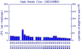
Flow Notes: The Río Shutaque has a flow gauge.
 |
Nearby Tourist Attractions: Copán Mayan ruins across the Honduran border; Esquipulas cathedral pilgrimage site an hour away.