 rivers | guidebooks | forums | tips | other
.jpg)
Class: II+; Ave. Gradient: 3 m/km; Portages: wood?; Length: 6 km; Time: 1 hour
Season: July to October; rafts? no; Highlights: nice gorges; Crux move: poor shuttle roads
Water Quality: poor; Water Temperature: cool
PI: San Nicolás (920 m); TO: El Tempisque vado (900 m)
Description: (click here for general notes about my descriptions)
The Middle Río Salamá provides one of the better beginner runs around when the water is up, and the trash doesn’t bother you. you do see some people along this run but this only adds to the atmosphere as the women here wear beautiful traje.
A full description is in the Mayan Whitewater Guatemala guidebook.
Descent History: Nils Saubès and I ran this in September 2013, with a flow of 300 cfs.
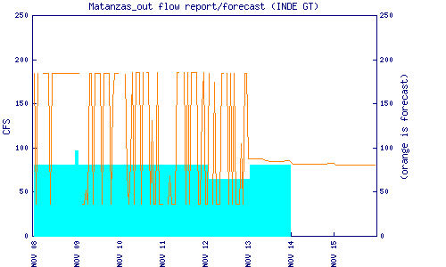
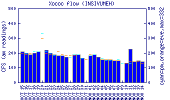
Flow Notes: The Río Salamá needs heavy rains to come up. Some of the flow will come from the Matanzas river and dam: the dam has a gauge. The gauge on the parallel Río Xococ should give a good hint as to general water levels in the other tributaries.
 |
 |
Nearby Tourist Attractions: not much in this area.