 rivers | guidebooks | forums | tips | other
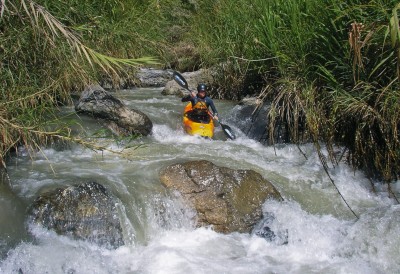
(photo by George Pratsinak)
Class: IV+; Ave. Gradient: 36 m/km; Portages: wood; Length: up to 12.5 km; Time: up to 6 hours
Season: June to February; rafts? no; Highlights: continuous mini-creeking; Crux move: some caution
Water Quality: average; Water Temperature: medium
PI: roadside (1110 m to 905 m); TO: roadside (905 m to 655 m)
Description: (click here for general notes about my descriptions)
The Upper Río Polochic is a beautiful and narrow continuous creek, one of the best in Guatemala partly thanks to its constant stream of water, usually clear, plus a gauge to indicate if there is enough. Another bonus is that it is roadside, meaning you can hike out from pretty much any point to the road. It is pretty tight in spots, and too much bamboo and wood can be annoying or even a problem, but if you proceed with caution—expect to get out of your boat often to scout—there are an awful lot of limestone rapids to enjoy. You can also expect some trash in the river since the many small communities do not have garbage collection.
A full description is in the Mayan Whitewater Guatemala guidebook.
Descent History: “Mad Max” Mark Young and Josh Anthony recorded the first descent starting below Tamahú in 1995. I have run the Cabiljá section, once, in August 2008.
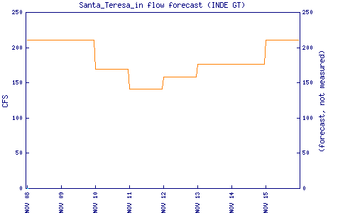
Flow Notes: The Santa Teresa hydro inflow estimate at the TO is the best hint we have to Upper Polochic flow. Downstream, the Río Polochic has an online gauge (not working in 2023), located in Telemán, downstream of both the dam and the confluence with the Río Matanzas (which is larger). The dam limits flows during the day so you have to average the day and evening readings to guess the level. I have not calibrated many post-dam readings; in 2014, 1.4 on the gauge meant a lower than-desirable level on the Upper. Hitting a decent flow on the Upper seems to be a 50/50 proposition.
 |
Nearby Tourist Attractions: Biotopo de Quetzal nature preserve.