 rivers | guidebooks | forums | tips | other
 (9).jpg)
(photo by Alejandro "Tico" Mendoza)
Class: IV+; Ave. Gradient: 7 m/km; Portages: one important one; Length: 36 km; Time: 7 hours
Season: June to October; rafts? no; Highlights: hot springs and remote feeling
; Crux move: V+ Ataque Cardiaco
Water Quality: poor; Water Temperature: not noted
PI: El Jobo border bridge (300 m); TO: Pedro de Alvarado
Description: (click here for general notes about my descriptions)
The Lower Río Paz should be a classic. It has great scenery, plenty of whitewater action, and even natural hot springs. Plus it has gauges that work most of the time. Commercially it is not perfect though: the water is often low, and it is pretty long for a 1 day trip. The final, easier part of the run used to be run as a day-trip by the Salvadorean company Rios Aventuras, but they don’t operate any more.
A full description is in the Mayan Whitewater Guatemala guidebook.
Descent History: Rafael Leret, founder of Rios Aventuras (El Salvador), and others, descended the Río Paz in 2000, by raft. They miraculously floated through Ataque Cardiaco upright after missing the eddy. Most of their subsequent trips put in below this point, carrying gear in with mules.
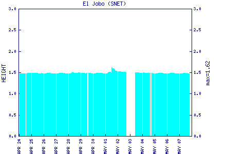
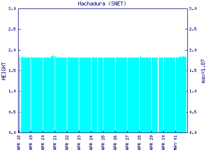
Flow Notes: This is the only run in Guatemala with online gauges both at the PI (El Jobo) and the TO (Hachadura) (El Salvador gets the credit here though). In 2016, 1.7 on the El Jobo gauge gave 850 cfs, a bit bumpy. In 2011, 2.3 on the gauge translated to 3,000 cfs. In 2007, 2.2 on the gauge gave to 1,900 cfs. In 2004, 1.8 gave 1,000 cfs (fine for kayaking). The upper limits on flow have not been “investigated” (3,000 cfs was OK for example); the crux, again, is Ataque Cardiaco.
 |
 |
Nearby Tourist Attractions: not much in this area.