 rivers | guidebooks | forums | tips | other
Class: IV; Ave. Gradient: 10 m/km; Portages: maybe a couple; Length: 16 km; Time: 4:30
Season: June to October; rafts? no; Highlights: pretty bedrock; Crux move: careful scouting at end
Water Quality: poor; Water Temperature: medium
PI: Pacaranát bridge (elev: 1600m); TO: Río Negro
Description: (click here for general notes about my descriptions)
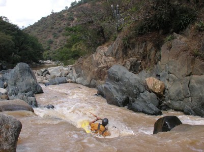
The Río Pacaranát offers a nice long tour of some bedrock gorges and is not as stressful as the parallel Serchil or Cajulá runs. The first 13 km of this run are creeky and rocky. It starts off with 30 minutes of class II down to the Paviolín bridge. Then you start to pass through many pretty shallow gorges of basalt rock, which I label class IV for the care that should be taken, though the actual rapids are generally class III. The rock formations are quite striking. In between there are boulder gardens of colorful granite.
A full description is in the Mayan Whitewater Guatemala guidebook.
Descent History: I ran this in October 2006, with Maarten Bleijerveld and Bob Vranich. We had 150 cfs at the PI and 500 cfs at the TO.
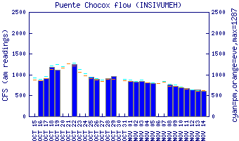
Flow Notes: The Río Pacaranát is usually bigger than both the Río Serchil and Río Cajulá and usually has enough water during September and October, and sometimes before. I have not correlated flows with the Río Negro (phone) gauge. The gauge on the Lower Río Negro, shown below, will give a hint to relative levels in the drainage.
 |
Nearby Tourist Attractions: markets at Chichicastenango, Aguacatán.