 rivers | guidebooks | forums | tips | other
Class: V; Ave. Gradient: 12 m/km; Portages: yes; Length: 11 km; Time: 4:00
Season: July to February; rafts? no; Highlights: challenging rapids; Crux move: negotiating the dam
Water Quality: decent; Water Temperature: not noted
PI: Chajbelén road bridge (245 m); TO: Río Cahabón con uence? (111 m)
Description: (click here for general notes about my descriptions)
The Río oxec has some of the steepest rapids in eastern Guatemala. It has gained a reputation as a killer by claiming a life of a boater on one of the three descents that have been attempted to date. The river descends through a steep and lush jungle valley that recently has been marred due to the construction of a hydroelectric dam which went into operation in 2016.
A full description is in the Mayan Whitewater Guatemala guidebook.
Descent History: Kayaker Mari Stam (founder of Stam outdoor Adventure Sports in Holland) died on the first descent in January 2002.
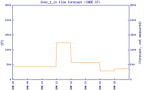
Flow Notes: The Oxec dam reports an estimate of inflow (it was the least they could do). The Río Oxec has runnable flows in the heart of the rainy season. After October, the area is more prone to dry spells. The part below the dam might only be runnable in high water/spill conditions.
 |
Nearby Tourist Attractions: Here you are halfway between Lanquín and El Estor.