 rivers | guidebooks | forums | tips | other
.jpg)
Class: IV, II, IV+; Ave. Gradient: 10 m/km; Portages: possibly, in Middle; Length: 11+8+28 km; Time: 1.5+1+5 hours
Season: June to October; rafts? no; Highlights: the creeky Upper, and pretty Middle canyon; Crux move: catching the water
Water Quality: OK; Water Temperature: cool to cold
PI: upper bridge (1100 m), highway bridge (990 m), Monjas (950 m), or Corinto (825 m); TO: Catorche I/II bridges
Description: (click here for general notes about my descriptions)
The Río ostúa is the largest river to leave the Guatemala border eastward. In El Salvador
it is collected in the Lago de Güija which is a hydroelectric reservoir, then joins the Río
Lempa in its long path to the Pacific. However, most of the gradient is in Guatemala, and
offers several runs of varying difficulty.
A full description is in the Mayan Whitewater Guatemala guidebook.
Descent History: I first ran the Middle/II in September 2003, and the Upper in August 2007. I have seen the Middle with flows of 300 to 900 cfs, and the Upper with 250 cfs.
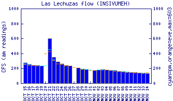
Flow Notes: The Río ostúa has a couple of handy guages. Las Lechuzas is in the Lower section and Las Cruces is farther downstream. In rainy periods the Middle will have kayakable flows. Mid-September and mid-October are, as usual, your best bets.
 |
 |
Nearby Tourist Attractions: not much in this area.