 rivers | guidebooks | forums | tips | other
.jpg)
Class: IV-, III+; Ave. Gradient: 11 m/km; Portages: yes, in Middle; Length: up to 31 km km; Time: up to 6 hrs
Season: June to October; rafts? when high; Highlights: bigger rapids; Crux move: negotiating small dams
Water Quality: decent; Water Temperature: medium
PI: Río Ocos bridge near San Luis (400 m) or Cabañas bridge (230 m); TO: Caballo Blanco (60 m)
Description: (click here for general notes about my descriptions)
When looking for medium-sized, not-too-committing class IV in this part of the country, the Río Ocosito might fit the bill—when the water is up. The Middle section has some fun rapids, but also a couple of small dams, to negotiate. The Lower section is a nice long class III stretch suitable for some exercise, working on intermediate paddling skills, and sometimes for some play.
A full description is in the Mayan Whitewater Guatemala guidebook.
Descent History: Roberto Rodas and I ran the Río Ocosito, from the highway down, in October 2003. We had only 350–500 cfs.
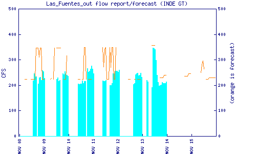
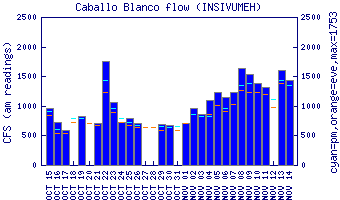
Flow Notes: The more water the better on this run. Upstream, the new Las Fuentes dam forecasts and reports releases. Downstream, there is a gauge at Caballo Blanco, which includes water from the Ríos Xab and Nil. The actual flow is about 15% less than reported.
 |
 |
Nearby Tourist Attractions: Xocomil/Xetulul water/amusement parks; Champerico beach.