 rivers | guidebooks | forums | tips | other
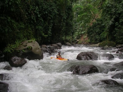
(photo by Gary Lee Chrisman)
Class: IV; Ave. Gradient: 23 m/km; Portages: a few; Length: 9 km; Time: 3:00
Season: June to early November; rafts? no; Highlights: beautiful narrow gorges; Crux move: avoiding the class VI slots
Water Quality: good; Water Temperature: cool
PI: coffee plantation (elev: 605 m); TO: Río Ocos bridge (400 m) near San Luis
Description: (click here for general notes about my descriptions)
The Upper Río Ocosito is a Pacific coast classic and the ultimate in continuous gradient creeking. It has more blind turns into narrow mini-canyons (and other unique features) than any other class IV creek that I know. The jungle scenery is fantastic too! The rapids do change a lot year-to-year, though, so scout carefully.
A full description is in the Mayan Whitewater Guatemala guidebook.
Descent History: First descent was on 25.8.03 by Greg Schwendinger. It's been run a handful of times, with up to 400 cfs at the PI.
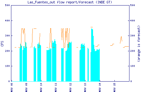
Flow Notes: The new Las Fuentes dam, besides obstructing this run, forecasts and reports releases. There is also an online gauge downstream at Caballo Blanco below the confluence of the Nil/Xab so there's no definite correlation. The Río Ocosito holds its water better than most coastal drainages, and the water channels well, so you're pretty sure to have enough water July through October. Anyway you can scout the river from the TO easily; if it looks borderline, I say go for it, since the best/first half necks up nice. The second half is wider and shallower, so when in doubt, be prepared to TO at the San Luis bridge. The new El Manantial hidro project upstream will have some effect on flows but it is not clear what effect.
 |
 |
Nearby Tourist Attractions: Santiaguito Volcano (active); Takalik Abaj Mayan ruins; Xocomil/Xetulul water/amusement parks; Patrocinio nature reserve.