 rivers | guidebooks | forums | tips | other
.jpg)
Class: IV-; Ave. Gradient: 21 m/km in Upper, 10 m/km in Lower; Portages: one in Lower; Length: 13.5 + 23 km; Time: 2 + 4 hours
Season: June to October; rafts? no; Highlights: beautitul jungle; Crux move: hike in on the Upper, getting around the dam on the Lower
Water Quality: good; Water Temperature: cool
PI: Finca San juan Bautista (515 m), or CA-2 (237 m); TO: CA-2 or Caballo Blanco (60 m)
Description: (click here for general notes about my descriptions)
The Río Nil is a gorgeous little creek and about as pristine a one as you will find on the Pacific coast. The Upper section starts in a coffee finca, and adding to the atmosphere is a 25-minute hike down a steep ravine to the PI.
A full description is in the Mayan Whitewater Guatemala guidebook.
Descent History: I first ran the Río Nil solo in September 2005, with 150 cfs at the PI
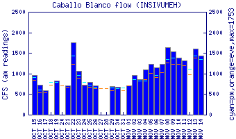
Flow Notes: You need heavy, recent rain for a good level on the Río Nil. The only working gauge is downstream on the Río Ocosito, which also includes the Río Xab. Otherwise you can check the flow at the highway bridge, km 190.1. The new El Manantial hidro project up in the headwaters may have a debilitating effect on the Nil in the future but hopefully not a major one.
 |
Nearby Tourist Attractions: Takalik Abaj Mayan ruins.