 rivers | guidebooks | forums | tips | other
Class: V-; Ave. Gradient: 18 m/km; Portages: a couple; Length: up to 22.5 km; Time: 5-6.5 hours
Season: June to October; rafts? no; Highlights: long narrow canyons; Crux move: a prayer to the mountain gods
Water Quality: decent; Water Temperature: medium?
PI: Finca La Chácara (650 m) or Finca Santa María (540 m); TO: El Naranjo (244 m)
Description: (click here for general notes about my descriptions)
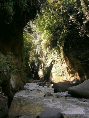
I just can’t resist a narrow committing canyon, at least when the average gradient is reasonable. The Río Nicán is one of the most eerily beautiful of the Pacific coast’s basalt canyons, featuring a 3 km unbroken stretch of deep jungle gorge, and other committing sections. The rapids are mostly in the class IV range but change flood to flood. Not all will be scoutable, and some will abuse your boat. You go in hoping that you can portage the undercut rapids and unfriendly wood. So far (three times), it’s worked out. At high water (> 400 cfs) I would consider the run a V+, considering the consequences and blind drops.
A full description is in the Mayan Whitewater Guatemala guidebook.
Descent History: Paul Heesaker and josh Anthony first ran this in 1996 or 1997; see the story in the guidebook. I first ran it in June
2007, with 150 cfs at the PI, again in early November 2009, with 350 cfs at the PI, and again in October 2016, with 200 cfs.
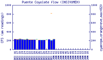
Flow Notes: The Río Nicán is usually a bit too low (although the runout on the Río Xayá is floatable year-round). The first thing to check is the level of the Río Coyolate at the highway bridge (km 105.5). The PIs will have 20-25% of the Río Coyolate flows normally. The higher the flow, the more full-on the run. I would think twice before attempting it with more than 400 cfs at the PI (i.e., Coyolate at 1,600 cfs or more).
 |
Nearby Tourist Attractions: Lago Atitlán, Los Tarales nature reserve.