 rivers | guidebooks | forums | tips | other
.jpg)
Class: IV; Ave. Gradient: 9 m/km, 15 m/km in Upper; Portages: none; Length: up to 33 km; Time: up to 5 hours
Season: June to October; rafts? Main; Highlights: Nentón canyon; Crux move: driving all the way out here
Water Quality: poor from Nentón down; Water Temperature: cool
PI: Buena Vista (1008 m) or Nentón (778 m); TO: Hacienda La Libertad (617 m)
Description: (click here for general notes about my descriptions)
The Río Nentón is the most northwest of the Northwest. But with a good road leading to it, nice tropical forest, and fun moderate class IV rapids, it shouldn’t be overlooked by paddlers passing through the area.
A full description is in the Mayan Whitewater Guatemala guidebook.
Descent History: Nils Saubès and I ran this one in October 2014.
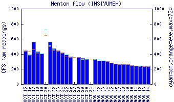
Flow Notes: There is a gauge in Nenton town!
 |
Nearby Tourist Attractions: the Cimarron sinkhole north of Nentón.