 rivers | guidebooks | forums | tips | other
.jpg)
Class: V; Ave. Gradient: 10 m/km Lower, 4 m/km Bottom; Portages: yes; Length: 32+32 km; Time: 5-6 hours each section
Season: June to December; rafts? a challenge; Highlights: being in the heart of Guatemala's mountains; Crux move: some class V
Water Quality: poor; Water Temperature: cool
PI: Sacapulas (1180 m); TO: Puente Chocox (940 m), Chirramos (815 m), or Chitomax (798 m)
Description: (click here for general notes about my descriptions)
The Lower Río Negro reprises the striking gorges and rapids of the Upper section. The valley is remote and long, and has a couple of challenging parts. As the most downstream section in this region, it is the only place to find boatable water when the creeks get low. Unfortunately, it is also the place to see the most trash in the bushes.
A full description is in the Mayan Whitewater Guatemala guidebook.
Descent History: This was first run by kayakers Ben Harding and Filip Sokol in 1977, before the Chixoy dam was built, on their epic exploratory all the way to Mexico. (Read Filip’s story on page 264.) In 1995 an Area verde Expedition raft-kayak group made the second descent.
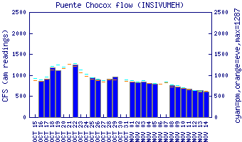
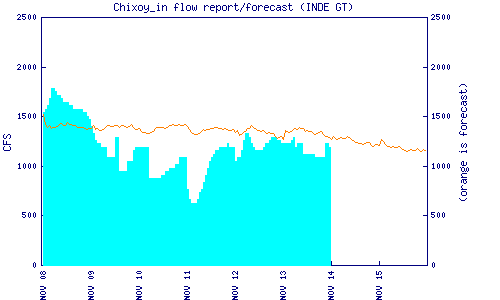
Flow Notes: There are two gauges: a gauge at the Lower TO, and the Chixoy dam inflow estimate (which includes some smaller tributaries from the Salamá area). The Río Negro almost always has enough water to run during the rainy season, and often into December. My impressions are from a run on the Lower in November 2006 with 450 cfs at the PI, and a run on the Bottom in October 2024 with 3,500 cfs.
 |
 |
Nearby Tourist Attractions: Highland markets.