 rivers | guidebooks | forums | tips | other
.jpg)
Class: IV/V, II/III; Ave. Gradient: 14 m/km Upper, 4 m/km Middle; Portages: yes; Length: 13+23 km; Time: 5+4 hours
Season: June to November; rafts? Middle; Highlights: Upper gorge; Crux move: gaining the trust of the locals
Water Quality: poor; Water Temperature: not noted
PI: Río Negro (1448 m), Llano Grande (1265 m), Tzununul (1233 m), or Río Blanco (1222 m); TO: Sacapulas (1180 m)
Description: (click here for general notes about my descriptions)
This is where the long west-to-east Río Negro river valley starts to take shape. The Upper section channels all the creeky energy of its tributaries into another amazing bedrock gorge, with a fun but challenging combination of geology and whitewater. The Middle section is much tamer, predominantly class I/II. The main issue currently for both these runs is the locals’ suspicion of outsiders, especially in the Upper section, where they are being especially aggressive in keeping away anyone suspected of being involved with the proposed Serchil dam. We were detained at Llano Grande on our first descent (see the story on page 210). There have been no problems, however, when running from Tzununul on down (an easy run with an easy shuttle)
A full description is in the Mayan Whitewater Guatemala guidebook.
Descent History: Maarten Bleijerveld and I first ran the Upper in October 2006, with a 500 cfs flow. I ran down through the Middle in June 2009. The lower part had previously been run by a raft group in 1997, starting on the Río Blanco (the group members were guides Roberto Rodas, Jennifer Miller, and Francisco Linga, Manuel Rodas, and the Hermanos Castillo).
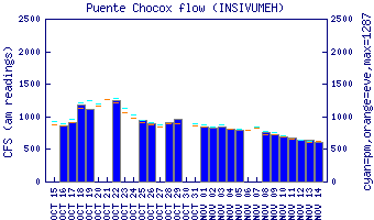
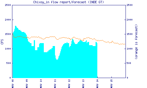
Flow Notes: The Río Negro often has enough water to run during the rainy season, and often into November, but will not hold during a dry spell. There are two useful gauges downstream on the Lower section, including the Chixoy dam inflow estimate) which are helpful (remember to subtract the Río Blanco gauge flow). The Río Negro (phone) gauge is helpful if still operating. In 2015, a reading of 1.44 was described as “low” (dry-season readings this year were as low as 1.10). In 2009, a reading of 1.24 gave a 350 cfs flow, which was lower than ideal for the Upper run but still fun. I have not seen a high flow but I imagine flows over 1,000 cfs could significantly increase the difficulty of the Upper section. In the Middle section, the more water, the better.
 |
 |
Nearby Tourist Attractions: not much right around here.