 rivers | guidebooks | forums | tips | other
.jpg)
Class: IV+; Ave. Gradient: 23 m/km; Portages: usually a couple; Length: up to 22 km; Time: up to 5 hours
Season: June to early November; rafts? no; Highlights: gorgeous canyons and tons of rapids; Crux move: an early start
Water Quality: decent; Water Temperature: cool
PI: Pacalum bridge (795 m) or San Antoñito (610 m); TO: Finca California bridge (370 m) or Panán bridge (290 m)
Description: (click here for general notes about my descriptions)
You want the Pacific coast’s best kayaking? The Upper Río Nahualate—a creek doing its best to hide in a deep river canyon—has it, with great rapids, reliable water, and stunning scenery. Get an early start and enjoy!
A full description is in the Mayan Whitewater Guatemala guidebook.
Descent History: As far as I know, I am the first person to descend this marvel from above Finca California. I first ran the lower part on May 31, 2005 and the upper part in September 2005 (both times solo).
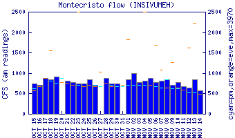
Flow Notes: The Upper Río Nahualate has reliable flows most of the rainy season, though during dry spells it can get bony. The flow about doubles from Pacalum to San Antoñito and triples by the Panán bridge. Less than 600 cfs at Panán (or 800 cfs at the CA-2 bridge) and you might consider starting at San Antoñito if you weren’t planning to already. There is a gauge on the Río Cutzán tributary which enters in the Middle section; it is a helpful but imperfect predictor of levels on the Upper Nahualate.
 |
Nearby Tourist Attractions: not much in this area.