 rivers | guidebooks | forums | tips | other
.jpg)
Class: IV/V; Ave. Gradient: 15 m/km; Portages: some short ones most likely; Length: up to 46 km; Time: 4-8 hours each
Season: June to November; rafts? no; Highlights: quality whitewater; Crux move: timing your run between earthquakes
Water Quality: poor; Water Temperature: cool
PI: La Garrucha (1290 m) or Chipérez bridge (935 m) or Chiquizayá (1530 m); TO: Chipérez bridge or Vega de Godinez (720 m)
Description: (click here for general notes about my descriptions)
The Upper Río Motagua provides the longest stretch of continuous advanced whitewater in Mayan Whitewater-land. It is fantastic stuff, with quality rapids, nice scenery, and a remote feel. Add to it the rest of the Río Motagua and you’ve got many days of worthy explorations. Thee difficulty is mostly class IV/IV+ but with some III and V sprinkled in. Having it so close to my home makes me really happy. Not that it’s perfect—the water is a bit polluted, and being on a major fault line there is the (incredibly small) chance that a large boulder could tumble on top of you. Ignoring those risks, enjoy your first descents, because surely the stirred and shaken rapids will have changed since this description.
A full description is in the Mayan Whitewater Guatemala guidebook.
Descent History: I first ran from Chipérez solo in September 2003, and from La Garrucha with Gary Lee Chrisman in October 2004. I get on parts of this most years. I have not paddled it at very low or very high flows.
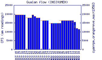
Flow Notes: The only working online gauge is way downstream at Gualán. Flows do not correlate very well. In 2012-2014, 1.5 on the gauge gave between 350 cfs and 1,200 cfs at Vega de Godinez (and 2.5 on the gauge gave 250 cfs at the Chiquizayá PI). You need recent rain to run the upper parts, and quite heavy rain for the Río Quisayá.
 |
Nearby Tourist Attractions: Mixco Viejo Mayan ruins near the Godinez TO.