 rivers | guidebooks | forums | tips | other
Class: III to IV; Ave. Gradient: 5 m/km; Portages: none; Length: up to 27 km; Time: up to 4 hours
Season: June to October (year round for easy kayaking); rafts? yes; Highlights: remote feel; Crux move: class IV at higher water
Water Quality: poor; Water Temperature: medium
PI: Concua (620 m) or Vega del Limón (515 m); TO: San Buenaventura (495 m) or La Canoa (473 m)
Description: (click here for general notes about my descriptions)
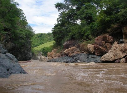
The Lower Río Motagua provides a very scenic trip through a warm remote valley. You get a nice workout without too much stress. The large multi-colored boulders and other rock formations are quite special, and compete with the rapids for your attention. you may spot iguanas also. The Lower can be run at a wide range of water levels, making it an option in the dry season. (To appreciate the full range of water levels this river experiences, take a gander at the high water line during your run.)
A full description is in the Mayan Whitewater Guatemala guidebook.
Descent History: I got on this solo in August 2007.
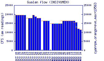
Flow Notes: The Río Motagua has gauges at Concua (Middle PI), and way downstream at Puente Orellana, Gualán, and Morales. The only gauge working in 2023 was Gualán. Flows do not correlate very well. In 2012-2014, 1.5 on the gauge gave between 350 cfs and 1,200 cfs at vega de Godinez. Below 1,000 cfs (the usual case) the river has been class III+. I have run the Lower up to 4,000 cfs which increased the speed and hole-dodging. Rafters have run the Middle at double that flow but no one has dared to challenge the Lower gorge at those levels (3.0 on the gauge gave ~8,000 cfs). The gauge at Morales is even further downstream.
 |
Nearby Tourist Attractions: Mixco Viejo Mayan ruins near the PI for the Middle section, and Guatemala City attractions.