 rivers | guidebooks | forums | tips | other
.jpg)
Class: V; Ave. Gradient: 11 m/km; Portages: yep; Length: 4 km; Time: 3 hours
Season: year-round; rafts? no; Highlights: river feature sightseeing; Crux move: reducing boat weight
Water Quality: poor; Water Temperature: medium
PI: La Canoa (473 m); TO: Los Olotes (430 m)
Description: (click here for general notes about my descriptions)
The Bottom part is where the last of the Río Motagua’s mountain gradient is exhausted, and it is unloaded in big chunks. The run is a big puzzle with consequences, and you will spend more time scouting and portaging than actually running the river. It makes for an interesting diversion any time of year.
A full description is in the Mayan Whitewater Guatemala guidebook.
Descent History: Maarten Bleijerveld, Andrew Hawley, Logan Hartle, and I got on this at very high water in August 2010. Nils Saubès and I explored it at very low water in December 2012.
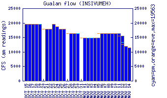
Flow Notes: The on working online gauge is downstream at Gualán. Flows are uncorrelated.
 |
Nearby Tourist Attractions: Mixco Viejo Mayan ruins near the PI for the Río Motagua Middle section, and Guatemala City attractions.