 rivers | guidebooks | forums | tips | other
Class: V; Ave. Gradient: 31 m/km; Portages: a plenty; Length: 7.5 km + Cocolá; Time: 5:00 + 1:30
Season: year-round; rafts? no; Highlights: challenging creek; Crux move: getting there
Water Quality: good; Water Temperature: cool
PI: Floresta (elev: 750m); TO: Yulá San Juan bridge (385 m)
Description: (click here for general notes about my descriptions)
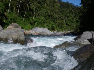
The Río Mixlaj off ers some challenging rapids in a beautiful and remote setting. No other PI in this book is as far from civilization as this one is, so the sense of accomplishment is gained not just by running the river, but also by getting to it. But the mountain scenery is so dramatic in these parts that if it weren’t for the boat on your shoulder or donkey, you might wish the trek were longer.
A full description is in the Mayan Whitewater Guatemala guidebook.
Flash Flood Danger: normal.
Descent History: The only descent I know about was mine in January 2010.
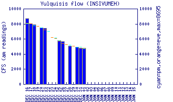
Flow Notes: There is a gauge way downstream on the Río Yulá San Juan. This river has some water year-round due to a lot of high-altitude drainage upstream. I would expect the river to be stomping in the high-water months of September and Octoboer. My impressions are based on a run in January with 500 cfs at the PI.
 |
Accommodations: The closest hotels are in Barillas, several hours away. The folks in Santa Marta are friendly and you should be able to find a family to put you up.
Nearby Tourist Attractions: The scenery on your drive in will be the major attraction.