 rivers | guidebooks | forums | tips | other
.jpg)
Class: V-, IV; Ave. Gradient: 40 m/km Upper, 28 m/km Middle; Portages: some; Length: up to 20.5 km; Time: up to 6 hours
Season: June to October; rafts? no; Highlights: waterfalls above and non-stop rapids below; Crux move: a hearty breakfast
Water Quality: average; Water Temperature: medium
PI: El Porvenir (960 m), Finca Sajbiná (840 m), or Finca Concepción (730 m); TO: Patulul bridge (345 m)
Description: (click here for general notes about my descriptions)
The Río Madre vieja is one of the more exciting creeks on the Pacific coast. With some cliffed-in waterfalls, the first few kms are more extreme than most runs in this book. The longer Middle section is super-continuous, enabling some extremely fast elevation drop.
A full description is in the Mayan Whitewater Guatemala guidebook.
Descent History: I first ran (solo) from Finca Concepción down in August 2003. In October 2006, I started from Finca Sajbiná with Maarten Bleijerveld and Bob Vranich. I first tried the Porvenir trail PI (solo) in July 2011.
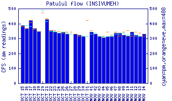
Flow Notes: The Río Madre vieja maintains a floatable water level most of the rainy season, but your boat will appreciate it if you wait for an extra rainy period. There is a gauge at the TO.
 |
Nearby Tourist Attractions: Lago Atitlán, Los Tarales nature reserve.