 rivers | guidebooks | forums | tips | other
.jpg)
Class: III; Ave. Gradient: 3 m/km; Portages: yes; Length: up to 50 km; Time: up to 3 days
Season: July to February; rafts? no; Highlights: mini-falls and monkeys; Crux move: planning
Water Quality: decent; Water Temperature: warm
PI: La Machacona bridge (235 m), or below; TO: San Antonio (105 m), or above
Description: (click here for general notes about my descriptions)
The Lower Río Machaquilá is a rewarding trip through the heart of the Petén. you will find many small travertine drops, and a few bigger ones, as well as plenty of jungle, some of it falling into the river. you will also see many birds—egrets, herons, kingfishers, and hawks—and you may even spot some howler monkeys. (And possibly crocodiles, though I have never seen one.) There are enough kilometers here to occupy 3 days, but 2 days are enough to see the best of it starting at Nuevo Paraíso.
A full description is in the Mayan Whitewater Guatemala guidebook.
Descent History: Albert Lisi made it most of the way down the Río Machaquilá in 1964 with a local guide in a small raft, as chronicled in his autobiographical account "Machaquilá." After abandoning the raft, they made it to the ruins, but almost failed to return via the overgrown jungle trail back to Poptún. In December 2012, Roberto Rodas, Max Baldetti, Sydney Shaw, and I made the next known descent (3 days in kayaks).
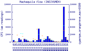
Flow Notes: There is a convenient online gauge at the main highway. I have experienced flows from around 400 cfs (1.0 on the gauge) to 1,500 cfs (1.5 on the gauge)..
 |
Nearby Tourist Attractions: Tikal Mayan ruins, Finca Ixobel guesthouse.