 rivers | guidebooks | forums | tips | other
.jpg)
Class: III; Ave. Gradient: 7 m/km; Portages: yes, wood and fences; Length: 4 to 11 km; Time: up to 3 hours
Season: July to October; rafts? no; Highlights: cloud forest kayaking!; Crux move: catching the water
Water Quality: good; Water Temperature: medium
PI: Saqhá nature reserve (1550 m); TO: Villa Sayaryf bridge (1520 m) or Matanzas dam (1470 m)
Description: (click here for general notes about my descriptions)
The Río Las Flautas is a rare gem: a navigable river in pristine cloud forest. While in this case the good forest only lasts about an hour, the scenery is worth the effort if you are lucky enough to catch the water.
A full description is in the Mayan Whitewater Guatemala guidebook.
Descent History: Nils Saubès and I got on this in September 2013, with 125 cfs at the PI.
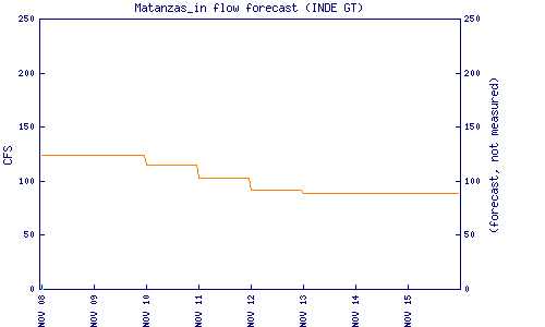
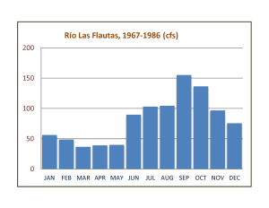
Flow Notes: The Río Las Flautas needs heavy rains to come up. you can check the flow at Villa Sayaryf, km 148.1. Historical flows are shown below. The TO bridge makes a convenient scouting spot. The Matanzas Hydro inflow chart (supposedly the flow at the San Isidro-Las Flautas confluence) is also helpful:
 |
 |
Nearby Tourist Attractions: Biotopo de Quetzal.