 rivers | guidebooks | forums | tips | other
Class: V-/V; Ave. Gradient: 12/20 m/km; Portages: usually; Length: 23/5 km; Time: 3 to 6 hours
Season: June to October; rafts? challenging; Highlights: scenery, a gauge, and lots of IV/V; Crux move: tearing yourself away from the hot springs
Water Quality: poor; Water Temperature: cool to warm
PI: San José bridge (528 m) or hot springs (elev: 502 m) or powerhouse (630 m); TO: Sinacantán bridge
Description: (click here for general notes about my descriptions)
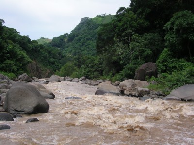
The middle section of the Esclavos is some mighty fine advanced boating tucked away in a gorgeous canyon. Add in reliable flows and you have the premier big-creek run of the Pacific coast. There are two parts to the middle Esclavos: the main run and the short but extreme hydro run above.
A full description is in the Mayan Whitewater Guatemala guidebook.
Descent History: 1st descent by Paul Heesaker, Max Young, Roberto Rodas, and Manolo Rodas, in a raft, in 1995. I have run it four times, most recently in 2013. The hydro run was first run in 1997 by Josh Anthony and friend; I ran it in 2011.
Flow Notes: The Río Esclavos has one of the biggest drainage areas of the coastal rivers, though the region sees less rain than in the west. The run has reliable water in the rainy season. My impressions are with flows that ranged from 800 cfs to 1,600 cfs. There is an online gauge (shown below) just above the run, the cfs readings seem to be accurate.
Note: There is a hydroelectric dam above the middle section but it has only minimal impact on boating. The reservoir is shallow from silt build-up so the dam is always spilling in the rainy season or pretty much anytime the generators is off for more than a day. The actual releases through the turbines are only 50 to 100 cfs, so are a negligible component in the rainy season and do little to help boaters in the dry season.
|
Nearby Tourist Attractions: The Tecuamburro Volcano and Laguna de Ixpaco are just off the shuttle route.