 rivers | guidebooks | forums | tips | other
.jpg)
Class: IV; Ave. Gradient: 26 m/km; Portages: some; Length: 6, 1.5 km; Time: 2, 0.5 hours
Season: June to December; rafts? no; Highlights: warm-up for the Río Copón; Crux move: blowing up the diversion dam first (just kidding)
Water Quality: decent; Water Temperature: cool
PI: Santa Avelina (1240 m); TO: Finca San Francisco (1085 m)
Description: (click here for general notes about my descriptions)
The Río Cotzal is the headwaters of the Río Putul. I have run two short sections up here, both quite busy and fun, but usually not with much water. Since then, water has been diverted from these streams, so you will only find boatable water during extra rainy times. The diversions take the water from these streams, and several others, through long canals eastward to the Palo Viejo dam and hydro.
A full description is in the Mayan Whitewater Guatemala guidebook.
Descent History: I ran the Río Chipal solo in November 2003. I ran the Río Cotzal with George Pratsinak in February 2008.
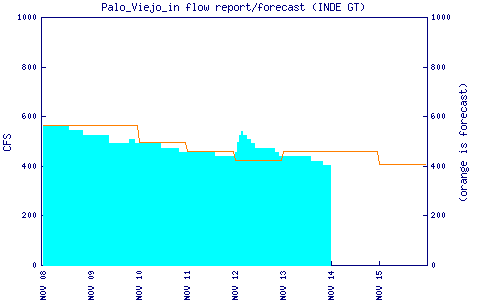
Flow Notes: These runs go with recent rain. The Palo Viejo hydro inflow estimate will give a good hint to agregate flows of both creeks.
 |
Nearby Tourist Attractions: The Ixil triangle: trekking and culture near Nebaj, San Juan Cotzal, and Chajul.