 rivers | guidebooks | forums | tips | other
Class: II+; Ave. Gradient: 2 m/km; Portages: El Camalote vado, and for wood; Length: up to 76 km; Time: up to 3 days
Season: year-round; rafts? yes; Highlights: easy jungle trip; Crux move: planning vehicle access
Water Quality: decent; Water Temperature: warm
PI: Las Flores Chiquibul (230 m), or lower; TO: Melchor de Mencos (93 m), or higher
Description: (click here for general notes about my descriptions)
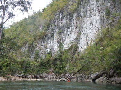
The Río Chiquibul (named Mopán further down) is a long and quite flat emerald green river lazily meandering towards Belize. This area is known to archeologists to having been densely populated by the Maya, but today it is mostly farmland, at least on the western/ Guatemalan side. Here you will find nice jungle scenery and interesting wildlife viewing. Besides the many kingfishers, herons, and egrets (and possibly toucans), you may enjoy iguana sightings and seeing river bats flying around in all parts of the river.
A full description is in the Mayan Whitewater Guatemala guidebook.
Descent History: The first raft descent was by Maya Expeditions in 1992.
Flow Notes: The Río Chiquibul almost always has enough water to scrape down, but higher water—July to January—is more enjoyable. on high water days (> 2,000 cfs), class III boat skills may be required for an incident-free descent. There is no online gauge, but the Río Machaquilá gauge should give an idea of the relative level. In 2015, 0.9 on that gauge gave 350 cfs at Los Flores Chiquibul, which was fine, but I wouldn’t want it much lower than that.
 |
Nearby Tourist Attractions: Tikal and Yaxhá Mayan ruins.