 rivers | guidebooks | forums | tips | other
.jpg)
Class: III, IV; Ave. Gradient: 7 m/km; Portages: wood; Length: up to 17 km; Time: up to 5 hours
Season: June to December; rafts? no; Highlights: Las Islas balneario; Crux move: wood
Water Quality: decent; Water Temperature: cold
PI: Chilaxito bridge (1415 m) or La Esperanza bridge (1360 m); TO: Las Islas (1300 m)
Description: (click here for general notes about my descriptions)
The Río Chicoy (a.k.a. Chilax in the upper part and Chió in the lower part) is a pretty little creek close to Cobán. It has too much wood in the Upper. The best part is the final 2 km of the Lower leading to the Las Islas balneario close to town, but watch out for wood! Contact me for more information.
Descent History: Maarten Bleijerveld, Alan Rasmussen, and I ran this in October 2007.
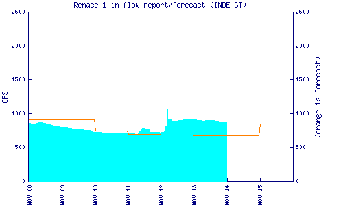
Flow Notes: The Chilax-Chicoy needs high water levels to go. The Renace I dam downstream reports an inflow estimate which is helpful. The Cobán rain gauge is also helpful.
 |
 |
Nearby Tourist Attractions: Cuevas de Rey Marcos in Chamelco.