 rivers | guidebooks | forums | tips | other
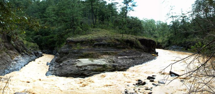
Class: IV-; Ave. Gradient: 10 m/km; Portages: one?; Length: 21 km; Time: 5 hours
Season: June to October; rafts? no; Highlights: exporing backroads; Crux move: gorge entrance
Water Quality: poor; Water Temperature: not noted
PI: Pachaquiejbeyá PI (1790 m); TO: Cajulá bridge (1580 m)
Description: (click here for general notes about my descriptions)
The Río Cajulá is a small river that varies in difficulty as it passes through narrow bedrock gorges and down the rugged Momostenango slope. The Upper section is easier than the Lower section except for one narrow gorge.
A full description is in the Mayan Whitewater Guatemala guidebook.
Descent History: Mark Shimanski and I ran this in September 2005, with 100 cfs at the PI and 400 cfs at the TO.
Flow Notes: The Río Cajulá needs regular heavy rains, most likely in June, September, and October. I have not correlated flows with the downstream Río Negro (phone) gauge. The gauge on the Lower Río Negro, shown below, will give a hint to relative levels in the drainage.
 |
Nearby Tourist Attractions: San Francisco El Alto animals market, Momostenango wool market, San Bartolo hot springs, Palá Chiquito hot springs.
mayanwhitewater.com, the guide to the rivers of Chiapas, Guatemala, Belize, Honduras, El Salvador, and Nicaragua © 2008-2024
![]()