 rivers | guidebooks | forums | tips | other
.jpg)
Class: IV; Ave. Gradient: 31 m/km; Portages: 1 or more; Length: up to 16 km; Time: 3 to 5 hours
Season: June to November; rafts? no; Highlights: bouldery creeking; Crux move: bouldery creeking
Water Quality: decent; Water Temperature: cool
PI: near San Rafael dam (850 m), La Piedrona (750 m), Cabúz III bridge (630 m), or Río Negro bridge; TO: Cabúz II
Description: (click here for general notes about my descriptions)
The Río Cabúz, chock full of granite boulders, contains some of the most continuous and action-packed rapids in Guatemala. Its long drainage starts on the slopes of the towering Tajumulco volcano. Add to this the region’s high rainfall, and you have one of the country’s premiere whitewater destinations. The upper sections offer quality clear water creeking to kayakers, while the lower sections open it up to larger boats.
A full description is in the Mayan Whitewater Guatemala guidebook.
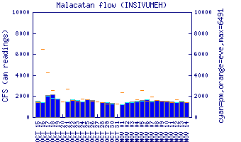
Flow Notes: The Upper Río Cabúz has water all rainy season long but unlucky extended dry spells can occur. There is an online gauge at Cabúz II. The level rarely gets impossibly high, though I have found that volumes above 350 cfs at Cabúz IV require more care and scouting. The rains can come early in the day in these parts, so get an early start.
 |
Nearby Tourist Attractions: Tajamulco volcano, Central America's tallest peak, is just uphill.