 rivers | guidebooks | forums | tips | other
Class: II+; Ave. Gradient: 3 m/km; Portages: none; Length: 18 km; Time: 2.5 hours
Season: June to October; rafts? no; Highlights: easy run; Crux move: catching the water
Water Quality: poor; Water Temperature: medium
PI: CA-2 bridge (110 m); TO: El Arisco (55 m)
Description: (click here for general notes about my descriptions)
The Lower Río Mocá provides one of the few long class II runs in the country. However, it has a lot of flat water and is usually too low for good paddling.
A full description is in the Mayan Whitewater Guatemala guidebook.
Descent History: Matt Hartell of Old Town Outfitters joined me for this one in September 2005.
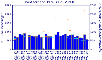
Flow Notes: If you see a boatable flow at the CA-2 highway, you are in luck! The gauge on the parallel Río Cutzán is a good indicator of relative levels.
 |
Nearby Tourist Attractions: El Semillero beach.