 rivers | guidebooks | forums | tips | other
Class: IV; Ave. Gradient: 16 m/km; Portages: maybe one; Length: up to 19 km; Time: 3:30
Season: June to October; rafts? yes, lower down; Highlights: pretty water and river features; Crux move: mini-gorges in upper half, "La Laja" rapid in lower half
Water Quality: good; Water Temperature: not noted
PI: Tres de Mayo (elev: 330m); TO: highway bridge
Description: (click here for general notes about my descriptions)
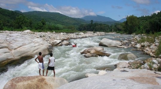
The Río Novillero is one of the Chiapas coast's most inviting runs, with clear water and granite boulder rapids.
In 2014, boaters report hard-to-see fishing cables at river height which are a significant hazard.
A full description is in the Mayan Whitewater: Chiapas & Belize guidebook.
Flow Notes: The Novillero has a sometimes-working gauge at the TO, shown below. The gauge reads high; in 2012, a 1200 cfs reading gave only 500 cfs real flow at the TO. You need recent rains for this run to go. My impressions are from a run with 200/900 cfs at the PI/TO.
 click here for the height graph |
Accommodations: There are basic hotels in Mapastepec.
Nearby Tourist Attractions: not much in this area.