 rivers | guidebooks | forums | tips | other
Class: III+; Ave. Gradient: 6 m/km; Portages: none; Length: up to 17 km; Time: 2:30 hours
Season: July to October; rafts? yes; Highlights: pretty roadside run; Crux move: finding a car mechanic
Water Quality: decent; Water Temperature: medium
PI: La Junta, or the San Marcos bridge (elev: 705 m); TO: 1 of 2 hammock bridges
Description: (click here for general notes about my descriptions)
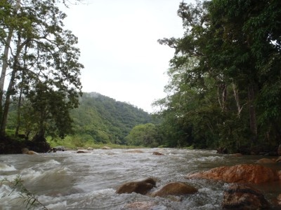
The Río Nacayumba is a pretty little creek out in the backwoods well to the south of Tuxtla Gutierrez bordering a protected area called the La Frailescana. The biggest challenge of the trip is making it across the terrible roads of the Villa Flores area to get there. Personally I think the run has potential as a family-friendly raft trip, but I guess it will be a while before an adventure company could make a go of it out here.
A full description is in the Mayan Whitewater: Chiapas & Belize guidebook.
Flow Notes: There is a convenient gauge downstream on the Río Nijundilo, shown below. The Nacayumba is about 85% of the Nijundilo but the gauge is not accurate. In 2012, a reading of 2100 cfs gave about 1200 cfs in the main run. Also here I include some historical data.

click here for the height graph |
 |
Accommodations: There are a couple of hotels in San Pedro Buenavista.
Nearby Tourist Attractions: none.