 rivers | guidebooks | forums | tips | other
Class: IV (III Lower); Ave. Gradient: 11 m/km (5 m/km Lower); Portages: 1 class V in Middle; Length: 16 km (up to 24 km Lower); Time: 3:30 (4:00 Lower)
Season: July to February; Rafts? lower; Highlights: roadside; Crux move: Las Gradas rapid
Water Quality: ok; Water Temperature: medium
PI: upper: Sacualpa (elev: 325 m); lower: Solosuchiapa (elev.: 155m); TO: Teapa or above
Description: (click here for general notes about my descriptions. thanks for Rocky Contos for extra beta.)
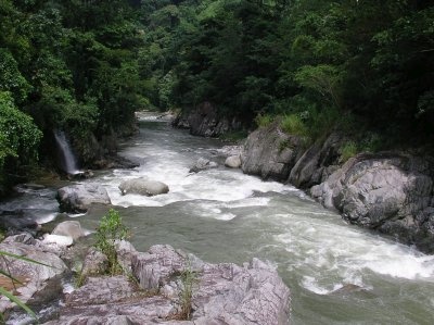
The La Sierra is a beautiful creek lying in a limestone bed in the heart of the northern Chiapas range. It also lies right along a major road so access is easy. In the Middle section the rapids are varied and require getting out of your boat from time to time. You may notice the flow increasing significantly from top to bottom. In the Lower the stream is wider and flatter.
A full description is in the Mayan Whitewater: Chiapas & Belize guidebook.
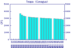
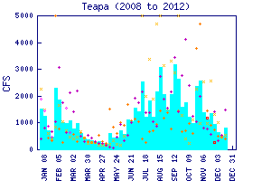
Flow Notes: There is online gauge at Teapa, linked to below (fairly accurate in 2009). (The Almandro-Pueblo Nuevo gauge is also downstream.) I believe you have a good chance to find a runnable flow August to October, but may need some luck outside these months. My impressions are from a run on the middle with 250/800 cfs at the PI/TO.

click here for the height graph |
 |
Accommodations: There are basic hotels in the larger towns along the main road.
Nearby Tourist Attractions: This area does not see many tourists. The rivers in this area (swimming holes and picnic areas) are the main draw for residents from nearby Villahermosa and other towns. There is also the Grutas de Cocona caves near Teapa.