 rivers | guidebooks | forums | tips | other
Class: IV+ (IV Lower); Ave. Gradient: 12 m/km (6 Lower); Portages: maybe; Length: 14 km (22 km Lower); Time: 4-8 hours (3-4 hours Lower), longer for rafts
Season: year-round; rafts? yes (class V); Highlights: beautiful travertine falls and canyon; Crux Move: not agitating the locals
Water Quality: good; Water Temperature: cool
PI/TO: Las Tazas (530m) to La Sultana bridge (lower: La Sultana (330 m) to La Soledad)
Description: (click here for general notes about my descriptions)
The Jataté is Chiapas' signature run, a jade-green river stairstepping through a remote and stunning canyon. This is your jungle river paradise postcard come to life. The Middle section is the most famous and prettiest part, but after driving so far you should take in a 2nd day on the lower also. Note that the Upper section and Far Upper section are described on another page.
A full description is in the Mayan Whitewater: Chiapas & Belize guidebook.
*note* This run is marked politically sensitive due to some confrontations with Zapatista communites in the area. Most of the people in the area are friendly but there are some who remain leery of river runners' interests and visitors should be aware that some tension exists. Tecojá is one such community near the river on the way to Las Tazas. The Chiapas & Belize guidebook recounts some of the incidents that have happened.
The guidebook recommends requesting permission at the La Garrucha Caracol before running the Jataté. However, the Junta at the Caracol may or may not give you an audience. If you are driving by just intending to do the Lower and/or Bottom sections, I still suggest stopping in and seeing about a permission letter. If you get the letter, great, you can show it to any community that asks you. If you don't, in my opinion it is still worth your while to put-on (unless the Junta expressly forbids it), and I would suggest doing so either at 1) the La Sultana bridge next to the army base, or 2) the Tzaconejá bridge at San Juan. The San Juan bridge bridge has the advantage of being 12 km earlier and giving you an extra 6 km of nice class III down to the confluence with the Jataté.
If you are running the Middle Jataté, currently I suggest just driving straight to Zapata and asking permission there.
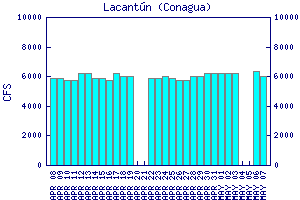
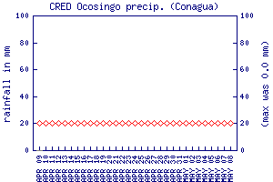
Flow Notes: The closest online gauge is way downstream on the Río Lacantún, shown below. The Middle Jataté has about 10% of that flow. The Ocosingo rain gauge can also give a clue to recent rain patterns. Perhaps the best time to go is November-December, but the run is available year-round. From January to mid-June it can get a bit scrapy though, and rafts should probably avoid it February to June. Also I don't have reports of runs at high water levels so be extra careful in September-October. My impressions are with 2000 cfs in the middle section and 3000 cfs in the Lower section. Here I also show historical data from INEGI, which has gauges near the PI and TO of this run:

click here for the height graph |
 |
 |
|
Accommodations: The closest formal accomodations are in Ocosingo.
Nearby Tourist Attractions: Toniná Mayan ruins; Laguna Miramar near San Quintín