 rivers | guidebooks | forums | tips | other
Class: V; Ave. Gradient: 9 m/km (> 300ft/mi near end); Portages: usually one; Length: 24 km; Time: 12 hours
Season: mid-June to January; rafts? no; Highlights: tall travertine; Crux Move: Butter Churn and Last Hole
Water Quality: decent; Water Temperature: cool
PI: Santa Rita bridge (800m); TO: Las Tazas road-side, before Tecojá
Description: (click here for general notes about my descriptions)
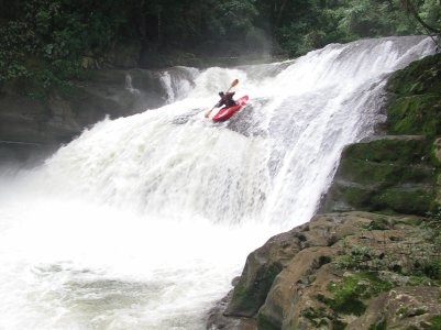
The Middle Jataté is Chiapas' signature run, a jade-green river stairstepping through a remote and sublime canyon. The Upper section steps it up to class V and beyond. The rapids and scenery are nothing short of amazing, but the final drops pose significant hazards, and the flash flood danger is very high. The run is not for the faint of heart.
A full description is in the Mayan Whitewater: Chiapas & Belize guidebook.
*note* This run is marked politically sensitive due to past confrontations with Zapatista communities near the TO. See the description for the Middle Jataté for more details. I had no problems at the described TO on my run in 2006.
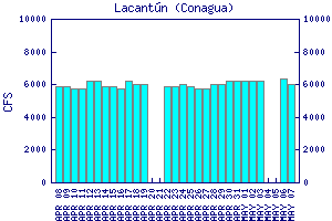
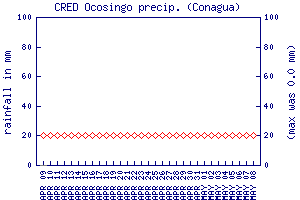
Flow Notes: The closest online gauge is way downstream on the Río Lacantún, shown below. The upper Jataté has perhaps 6% of that flow. The Ocosingo rain gauge can also give a clue to recent rain patterns. My impressions are with 450 cfs at the PI in December. Despite the fact that most of the run is better with more water, because of the crux I would very much advise anyone not to put-on with more than 600 cfs, and to think twice before putting-on with more than 400 cfs.
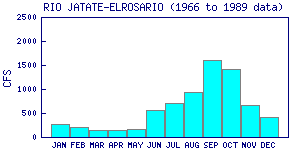
Here I also show historical data from INEGI, which has a gauge near the TO:

click here for the height graph |
 |
 |
Accommodations: There are many hotel choices in Ocosingo.
Nearby Tourist Attractions: Toniná Mayan ruins