 rivers | guidebooks | forums | tips | other
Class: II; Ave. Gradient: 1.4 m/km; Portages: none; Length: 36 km; Time: 6 hours
Season: year-round; rafts? yes; Highlights: mid-elevation jungle, villages; Crux Move: getting permission to float
Water Quality: good; Water Temperature: cool
PI: Emiliano Zapata (540 m); TO: Las Tazas or El Avellanal
Description: (click here for general notes about my descriptions)
The 34 km valley section of Río Jataté is a mellow float through a Zapatista region. While there are no real rapids, the river still has a bit of gradient that gives rise to plenty of easy class IIs. Although lacking in whitewater, the river has great opportunities to interact with the local Zapatista population, which can be an adventure in itself. Expect villagers to pull you over, question your motives, and perhaps search through your gear. As long as you can convince them that you are just a tourist, you should have no problems other than delays. To avoid any potential conflict and resolve demands for money before they arise, it is recommended that you obtain permission near the PI (see below).
A full description is in the Mayan Whitewater: Chiapas & Belize guidebook.
*note* This run is marked politically sensitive due to some confrontations with Zapatista communites in the area. Most of the people in the area are friendly but there are some who remain leery of river runners' interests and visitors should be aware that some tension exists. Tecojá is one such community near the river on the way to Las Tazas. The Chiapas & Belize guidebook recounts some of the incidents that have happened.
The guidebook recommends requesting permission at the La Garrucha Caracol before running the Jataté. However, the Junta at the Caracol may or may not give you an audience. If you are driving by just intending to do the Lower and/or Bottom sections, I still suggest stopping in and seeing about a permission letter. If you get the letter, great, you can show it to any community that asks you. If you don't, in my opinion it is still worth your while to put-on (unless the Junta expressly forbids it), and I would suggest doing so either at 1) the La Sultana bridge next to the army base, or 2) the Tzaconejá bridge at San Juan. The San Juan bridge bridge has the advantage of being 12 km earlier and giving you an extra 6 km of nice class III down to the confluence with the Jataté.
If you are running the Middle Jataté, currently I suggest just driving straight to Zapata and asking permission there.
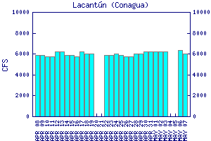
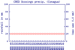
Flow Notes: The closest online gauge is way downstream on the Río Lacantún, shown below. The Middle Jataté has about 20% of that flow. The Ocosingo rain gauge can also give a clue to recent rain patterns. Perhaps the best time to go is November-December, but the run is available year-round. From January to mid-June it can get a bit scrapy though, and rafts should probably avoid it February to June. Here I also show historical data from INEGI, which has gauges near the PI and TO of this run:

click here for the height graph |
 |
 |
Nearby Tourist Attractions: Toniná Mayan ruins.