 rivers | guidebooks | forums | tips | other
Class: V-; Ave. Gradient: 24 m/km; Portages: a'plenty; Length: up to 13 km; Time: up to 9:00
Season: June to October; rafts? no; Highlights: deep valley scenery; Crux move: portaging safely
Water Quality: so-so; Water Temperature: cool
PI: La Verbena (elev: 433m); TO: "Huixtla" bridge or "El Material" bridge
Description: (click here for general notes about my descriptions)
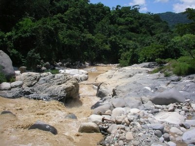
The Río Huixtla is the stream that follows the border road that descends to the Pacific coast from Motozintla through a gorgeous valley. The stream is quite steep (and muddy) and serves up plenty of challenging drops. The banks are granite and marble and at last report were scoured clean by hurricanes and storms.
A full description is in the Mayan Whitewater: Chiapas & Belize guidebook.
Flow Notes: There is a gauge near Huixtla town downstream, but sometimes the flow gauge is out. The gauge reads low, about half of real flow. This run often has enough water in the rainy season, but not always. My impressions are from runs on the upper/middle with 750/300 cfs at the Puente Huixtla. The river passes the coastal highway at km 249.8.
 |
 |
Accommodations: There are basic hotels in Huixtla.
Nearby Tourist Attractions: not much in this area.