 rivers | guidebooks | forums | tips | other
Class: V; Ave. Gradient: 14 m/km; Portages: ~10; Length: 26 km; Time: 12:00
Season: August to October; Rafts? no; Highlights: going where few gringos have; Crux move: long bedrock gorge
Water Quality: decent; Water Temperature: medium?
PI: Villa del Río (elev: 700 m); TO: Rio Negro (Pueblo Viejo) road bridge
Description: (click here for general notes about my descriptions)
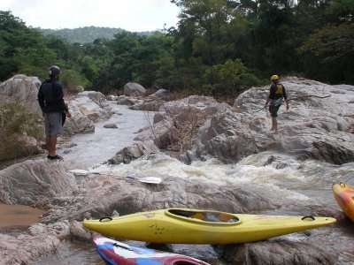
The Río Chiquito is a pretty creek hidden in the mountain ranges of the Chiapas/Oaxaca border. (The river is on the periphery of an area known as "Los Chimalapas" which is an important region for biodiversity and includes "the largest undisturbed cloud forests in all of Central America" according to the World Wildlife Fund.) This area sees very few visitors, or locals for that matter. The run offers up some low volume granite bedrock creeking with some nice technical challenges but with a higher-than average amount of scouting and portaging.
A full description is in the Mayan Whitewater: Chiapas & Belize guidebook.
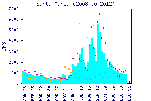
Flow Notes: There is a convenient online gauge downstream at Santa Maria, linked to below. This spot is below the confluence of the Río Negro, which is larger than the Río Chiquito. The readings seem pretty accurate. Below I also show history from the past several years. My impressions are from a run with about 200/400 cfs at the PI/TO.

click here for the height graph |
 |
Accommodations: There are hotels in Cintalapa.
Nearby Tourist Attractions: Not too many in this area.